Bounding Box
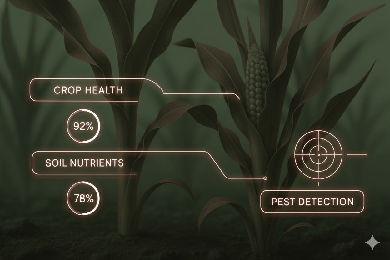
Tag pests, crop clusters, and anomalies in satellite or drone-captured field images for faster detection and training.

Labels that train smarter AI
We deliver annotations at scale for precision agriculture, from identifying crop stages to mapping soil and pest patterns, giving your AI the field-ready data it can trust.
In precision agriculture, one bad label can mean acres of wrong predictions. That's why we combine QA workflows built for spatial and temporal data with annotators who don't just know agri, they've lived it.
From object tracking in drone imagery to semantic segmentation of soil types, our in-house teams handle complex, high-volume data with confidence. And because every region grows different, we localize annotations to your crop, climate, and goals so models actually perform in the field.
Tag pests, crop clusters, and anomalies in satellite or drone-captured field images for faster detection and training.
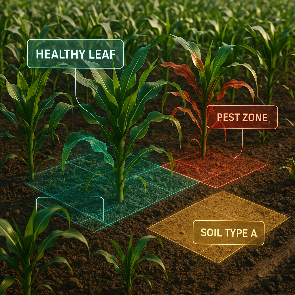
Enable high-precision mapping of irregular regions like leaf damage, soil patches, or weed clusters within large orthomosaics.

Frame-by-frame annotation of drone footage to track crop growth, disease spread, irrigation patterns, and more over time.
We power sustainable agriculture with precise annotation from regenerative mapping to carbon verification.
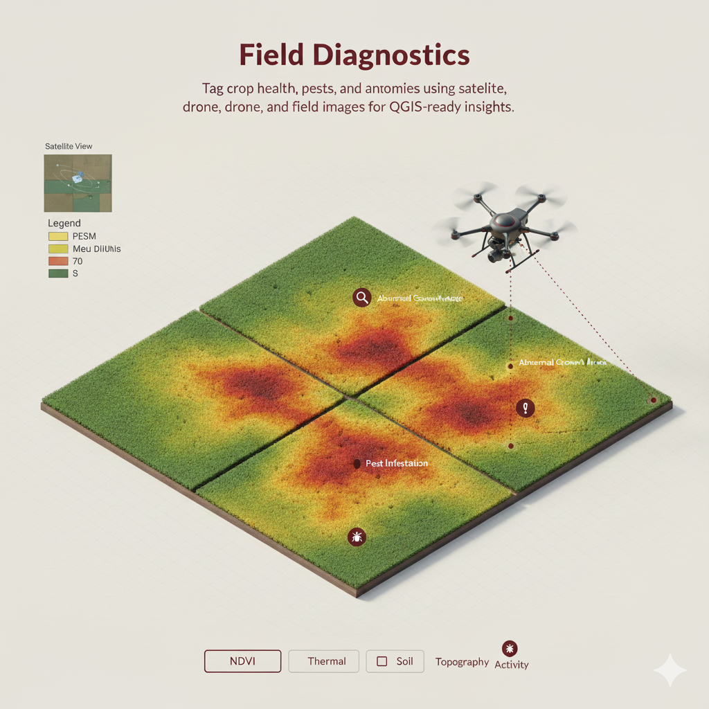
Tag crop health, pests, and anomalies using satellite, drone, and field images for QGIS-ready insights.
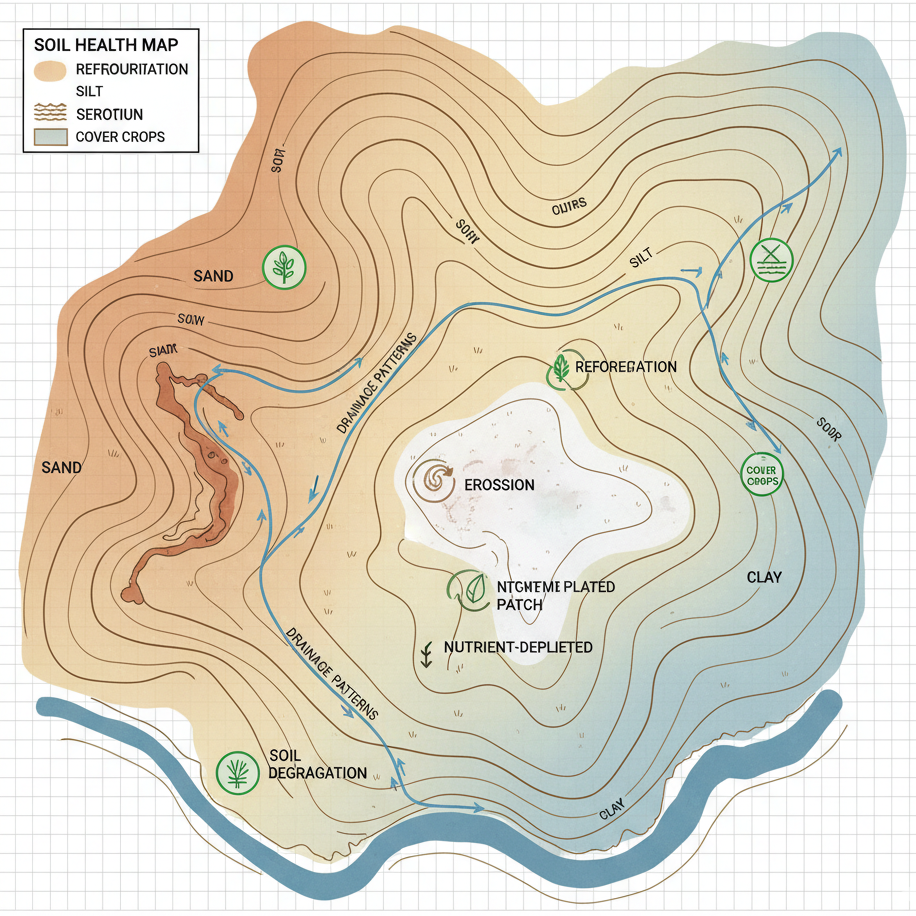
Label texture zones, drainage, and degradation patterns to help guide soil conservation and inputs.
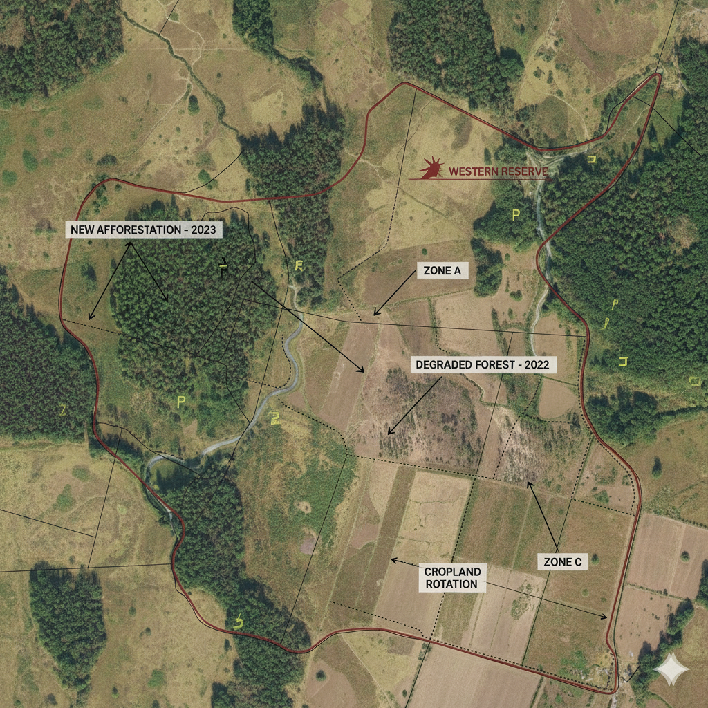
Support MRV protocols by tagging land use patterns, vegetation cover, and boundary changes.
Explore use cases in agri annotation from diagnostics to sustainability and supply chain visibility.
Quick answers to help you make smarter, faster decisions with confidence
We support image, video, text, and audio annotation tailored for agriculture, like bounding boxes for pest detection, polygons for crop fields and much more.
Yes. We customize every step from agri-specific label taxonomies and multi-stage QA to region-specific annotation logic using your tools or ours.
All annotations go through multi-tier QA and model-in-the-loop validation. Annotators are trained in crop types, pest behavior, and local patterns so mistakes don't scale.
Absolutely. We support multi-language annotation in English and major Indian languages.
Yes. We work with tools like QGIS, CVAT, and custom APIs to deliver outputs in formats like GeoTIFF, shapefiles, and JSON - ready for modeling or visualization.
Always. All data is handled in secure, in-house facilities under SOC2, GDPR, and HIPAA-aligned practices.
Tell us about your AI data requirements and our team will help map the right workflow.