Challenge
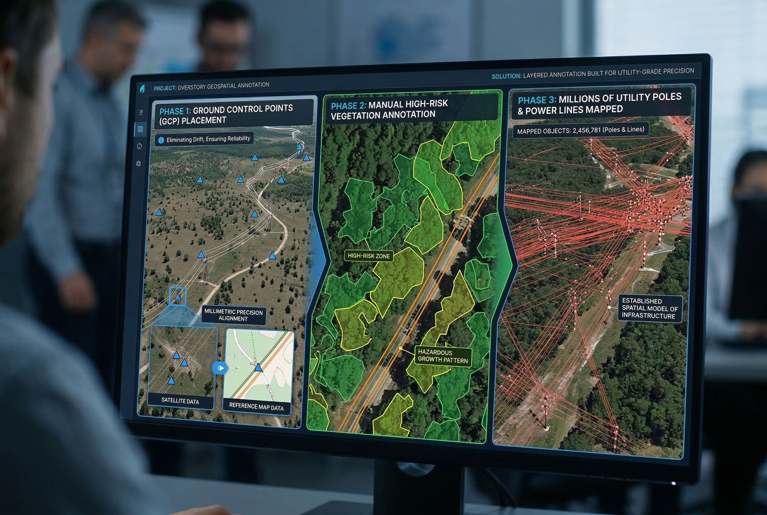
Converting Satellite Signals into Actionable Risk Intelligence
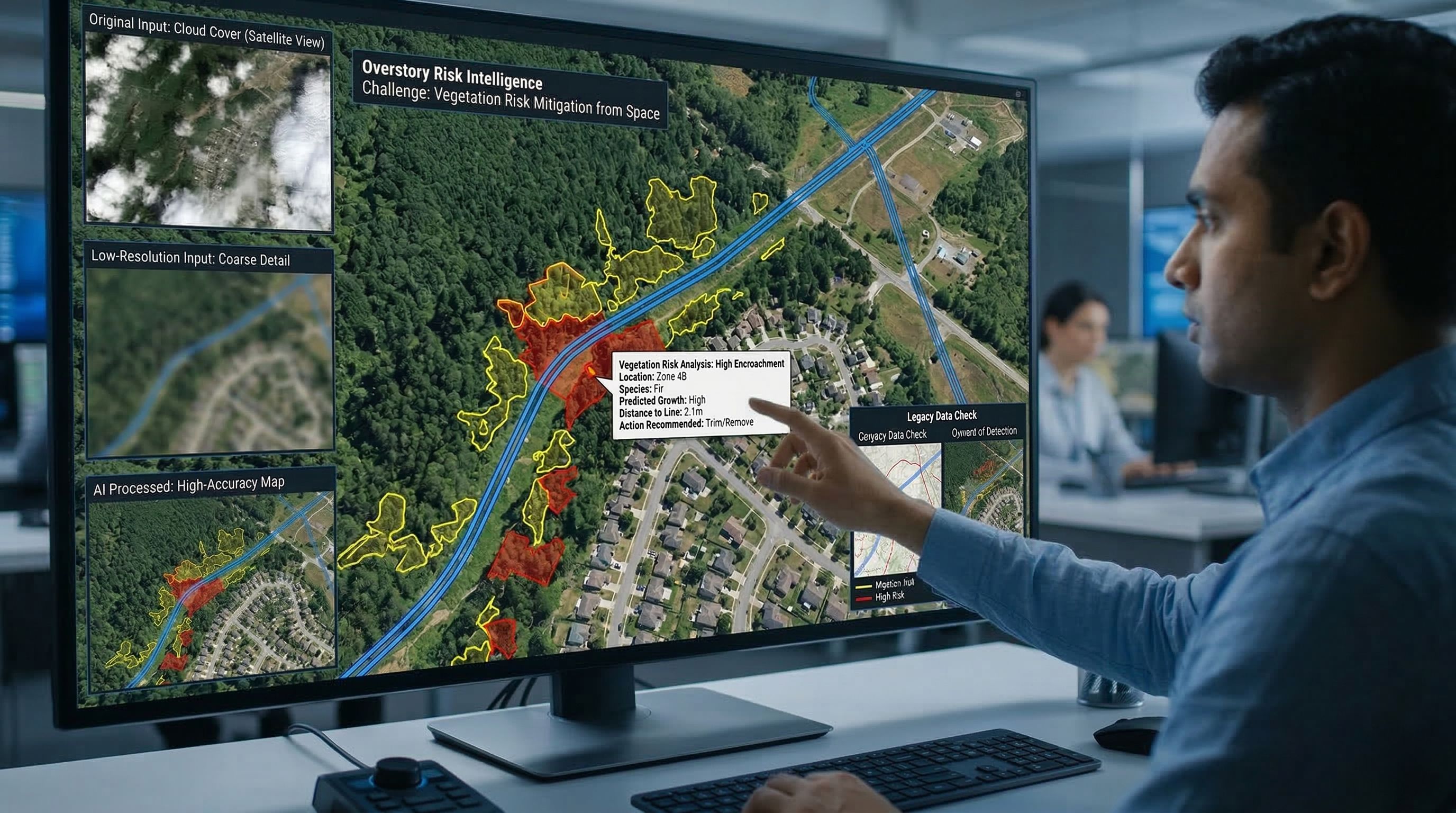
Helping utilities mitigate vegetation risk from space is no simple task. Overstory's AI needed high-accuracy, annotated imagery that could span dense forests, suburban corridors, and remote outposts. But satellite and aerial inputs came with the limitations of cloud cover, variable resolution, and outdated imagery, all making reliable AI detection harder to achieve at scale.
On top of technical constraints, utilities often relied on legacy data and remained rightly skeptical of AI-driven vegetation intelligence. Regulatory compliance demanded airtight data quality, while real-world conditions required human expertise to catch edge cases missed by machines. Overstory needed a partner who could meet both the scientific bar and industry-grade expectations without compromise.