Field Boundaries
Precisely digitized farm plots and buffer zones using orthomosaics, shapefiles, or satellite imagery.

Agriculture intelligence
Use QGIS, orthomosaics, and expert-led annotation to validate field boundaries, track soil vitality, and measure your carbon footprint with accuracy, transparency, and scale.
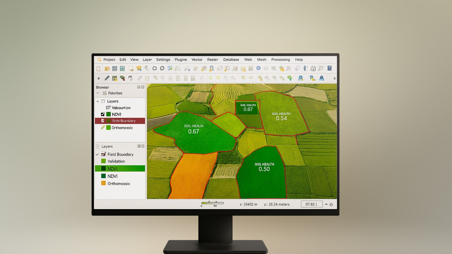
Sustainability starts with understanding your land. We use geospatial annotation, QGIS tools, and orthomosaic imagery to map agricultural fields with precision - validating boundaries, identifying soil variation, and tracking field health at a granular level.
But we don't stop at mapping. Our teams apply domain knowledge to annotate features relevant to carbon programs like cover crops, water stress indicators, and tilling patterns, ensuring every dataset fuels your regenerative goals. Whether you're verifying carbon impact or planning smart interventions, we deliver data you can act on.
Precisely digitized farm plots and buffer zones using orthomosaics, shapefiles, or satellite imagery.
Visual indicators of erosion, water stress, and vegetation vigor mapped for data-driven sustainability.
Mapped cover crops, tillage patterns, and residue levels to validate climate-smart farming practices.
We label geospatial and soil data to validate field boundaries, monitor agri-health, and prove carbon gains.
Map cover crops, tillage, and no-till practices to validate claims for carbon markets and green audits.
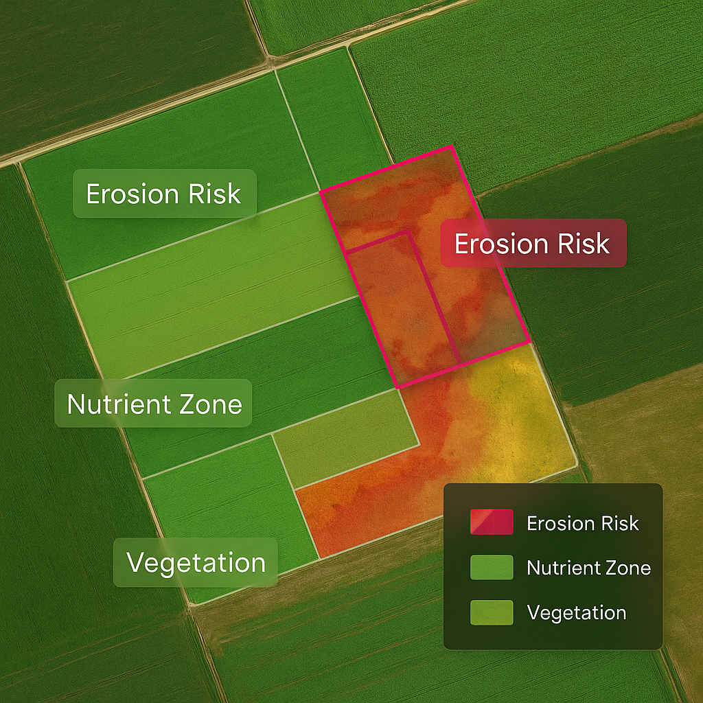
Label erosion risk, nutrient zones, and vegetation patterns to guide smarter, more adaptive practices.

Digitize field shapes from satellite or drone imagery to avoid leakage, double-counting, or subsidy errors.
Proof points from production-grade data operations.

Case Study
300K+
Hectares Covered
7
AI models Developed
96%+
Precision Achieved
Track, label, and verify sustainability efforts across diverse farmlands and datasets.
Quick answers to help you make smarter, faster decisions with confidence
Yes. We annotate directly within QGIS or ingest orthomosaic imagery for bounding box, segmentation, and shapefile outputs.
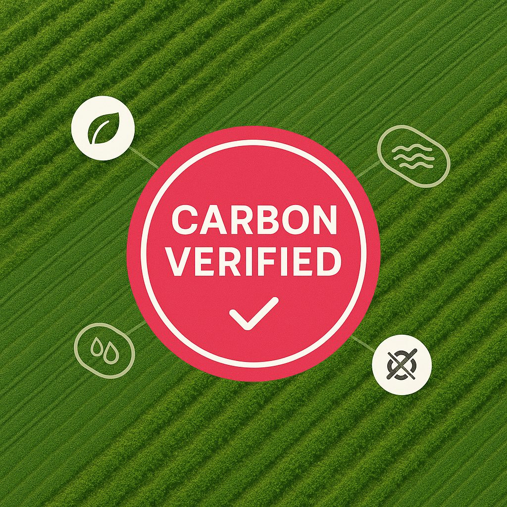
Absolutely. We annotate field boundaries, tillage patterns, and cover crops with audit-ready documentation for carbon programs.
We support drone, satellite, multispectral, RGB, and LiDAR data - across crops, soil types, and climates.
Through multi-layer QA, specialist training, spatial overlap checks, and AI-assisted validation to ensure consistency across frames.
Yes. We align with carbon offset protocols and can customize outputs to meet Verra, Gold Standard, and CDM guidelines.
Definitely. We work with custom plugins or APIs to fit right into your GIS workflows - whether cloud-based or on-prem.
Tell us about your AI data requirements and our team will help map the right workflow.